Southern Tier Part 3 - Day #13 Ocotillo, CA to San Diego, CA
Southern Tier Part 3 - Day #13
June 6, 2023
Ocotillo, CA - San Diego, CA 101 Miles
Start 6:47 AM Finish 8:39 PM
Total Duration 13:52
Moving Time 11:12
Stopped Time 2:40
Ascent 7708'
Descent 8092'
Tour Total 1059 Miles
Details at: https://ridewithgps.com/trips/123788665
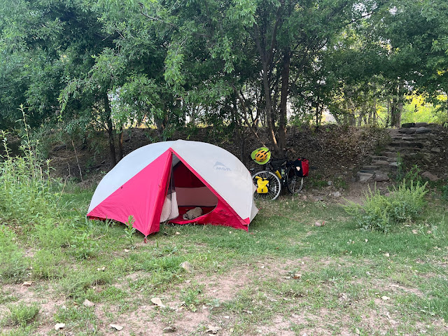
I slept ok on the cement slab behind the Red Feather Off-Road Market & Cafe in Ocotillo. The nearby Great Escape Food & Spirits had been open until 9 PM but I was too tired, and went to bed while the sun was still up. I had climbed into my tent at 5:30 PM. I was exhausted and the wind was turbulent. The mesh of the tent protected me from the blowing dust and fine sand. There was a nearby RV trailer park and people opened and closed the gate several times during the night. It was extremely windy all night long. Occasionally it would settle down for a moment, and I could hear the motor vehicles on Interstate 8. I woke up before the sunrise, and it was still windy. My Windy app forecast wasn’t working, and my weather app indicated that the wind would be slowing at 8 AM. I heard from my TransAm buddy Andy from San Diego, who told me that the climb out of Ocotillo would be tough. While I was packing I found a scorpion on my ground cloth directly beneath my tent. I packed away my brim and donned my gilet. It was a chilly 62°F and I put on my jacket.
The wind was ridiculous, but I was well rested and had three full water bottles. At minimum my goal was to make it seventeen miles up the first climb to Jacumba. Even if I only covered two miles an hour, I'd make it before I got too hungry. I skipped the Chevron as I pedaled out of town on Interstate 8. Because of the wind's loud roar, it was impossible to dictate into my phone. I had to pull over to manually type my notes or take photos of what I wanted to recall. My ear pods were in and a Duane Train program was playing, but I could barely hear it. The interstate east and west lanes split apart to navigate the pass separately. I kept being blown off the road into the gravel, and remounting the bike in my lowest gear was a challenge. I rode as far right on the shoulder as possible to minimize being blown into traffic. Eventually an asphalt curb appeared which I could use as a bank to ricochet off and propel myself forward.
I wasn't the only one having difficulty navigating the climb out of Ocotillo. I noticed motorcycles and semi-trucks pulled over on the shoulder. Construction workers were challenged trying to install a temporary Caution Road Work Ahead sign. And then I came to an overturned semi-truck. It had just blown over, and it was alarming to ride right next to the underside. It occurred to me that a truck could blow over on top of me. I continued to see border control vehicles. There were roadside cement tanks full of water for overheated radiators.
I had ridden about four miles when I rounded a turn and rode through a road cut. The gusts were ferocious and it felt like I was in a wind tunnel. The wind blew me to a stop and I had to dismount. It was the first time I'd ever had to hike-a-bike through wind. I summoned every bit of energy I had to push myself forward. I was able to remount after the road cut and keep pedaling forward in my lowest gear.
By 8:30 AM I’d gone seven miles. I was halfway up the first climb and almost midway to Jacumba. The wind had settled enough to be able to hear the music from my ear pods, and I could once again dictate into my phone. I was able to shift up a few gears. Then I rounded a turn and the wind returned. I came to the Devils Canyon Bridge #1 and decided to walk across the span because of the wind. There was only three feet to the right of the white line and I didn't want to be blown into traffic. I heard a strange chain rattling noise and realized that it was slats in the chain-link fence behind the handrail that were being blown by the wind.
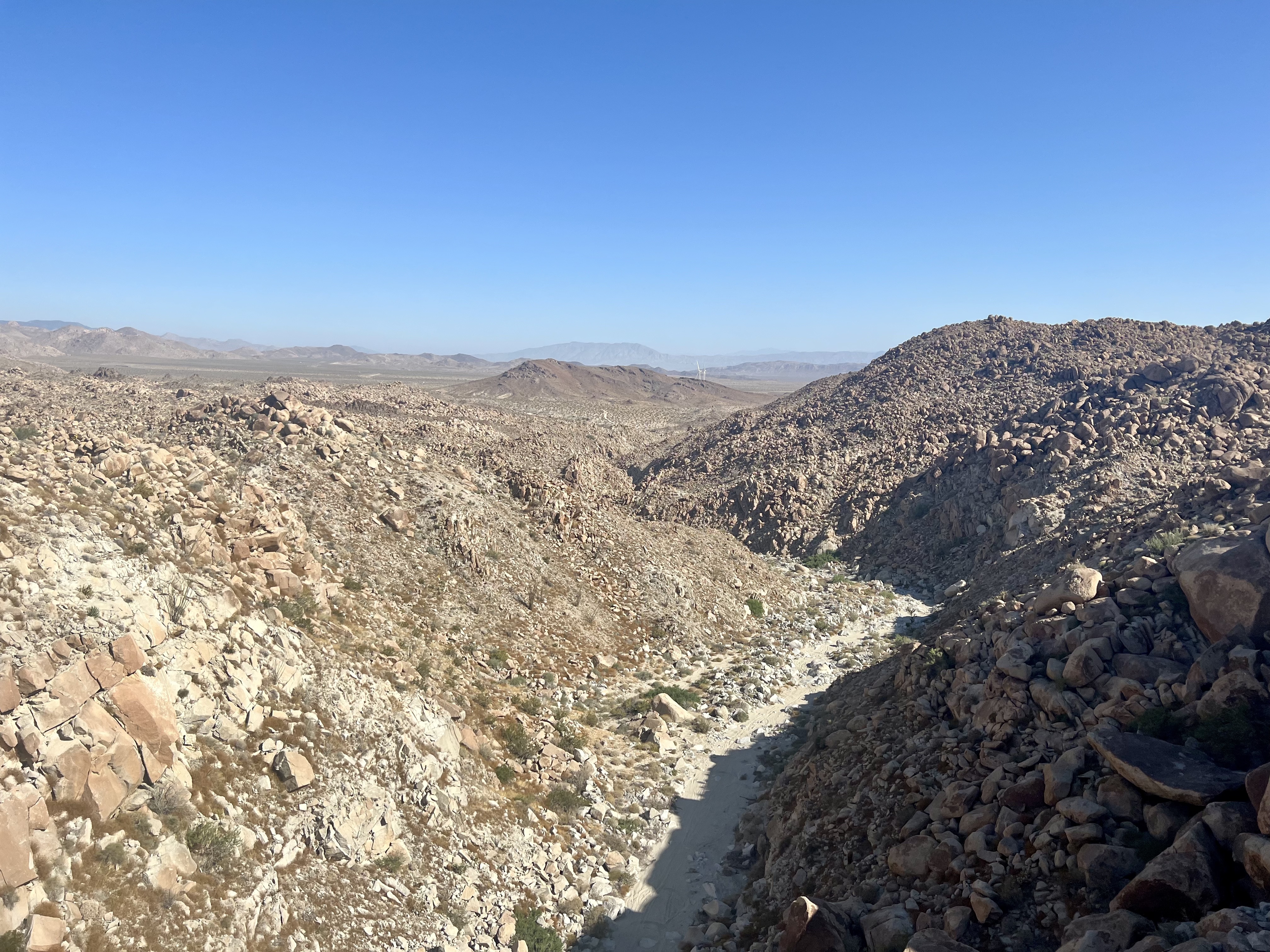
At 9 AM I came to a sign that said 'Elevation 2000 feet'. It was 9 AM and I had ridden eight and a half miles. The wind had settled again. The east and westbound lanes of Interstate 8 rejoined after the junction at Mountain Springs Road, and there was a large climb ahead. I was crossing the Jacumba Mountains.
By 9:30 AM I had gone ten miles and I was up to radiator tank number fifteen. I was starting to get warm and the wind wasn’t as bad. I could hear my music and dictate. As I neared the top of the pass, I pulled over and looked to the east to bid a farewell to the Imperial Valley. I noticed the Desert View Tower at the top of the pass. I was passed by more Border Patrol vehicles.
I crossed over Boulder Creek and noticed Coyote's Flying Saucer Retrieval and Repair Service, essentially a collection of discarded motor vehicles and oddities. I passed radiator tank number nineteen and saw a sign 'Elevation 3000 feet'. I noticed more abandoned trucks and motor vehicles to the side of the road.
I exited the Interstate on In-Ko-Pah Park Road, and rode through Oasis. There was a sign that said the population varied. It wasn't listed on my map and everything was shuttered. I took a left on two lane Old Highway 80 and crossed under the Interstate. It was nice to have the road back to myself. The high-speed traffic had been harrowing.
I finally reached the top of the pass, and could see down into the valley below. The border wall was in the distance, and I would have a downhill to Jacumba. The air was chilly and it was still windy. My weather app noted 65°F with thirteen mile-an-hour winds from the south/southwest. I passed Carrizo Creek Road and saw a power station and the border wall to my left. A Border Patrol vehicle was parked in the grass to my right.
The border wall was surreal, dark, scary, and apocalyptic. It was the opposite of the Statue of Liberty's 'Give me your tired, Your poor, Your huddled masses yearning to breathe free, The wretched refuse of your teeming shore'. A bunny shot across the road.
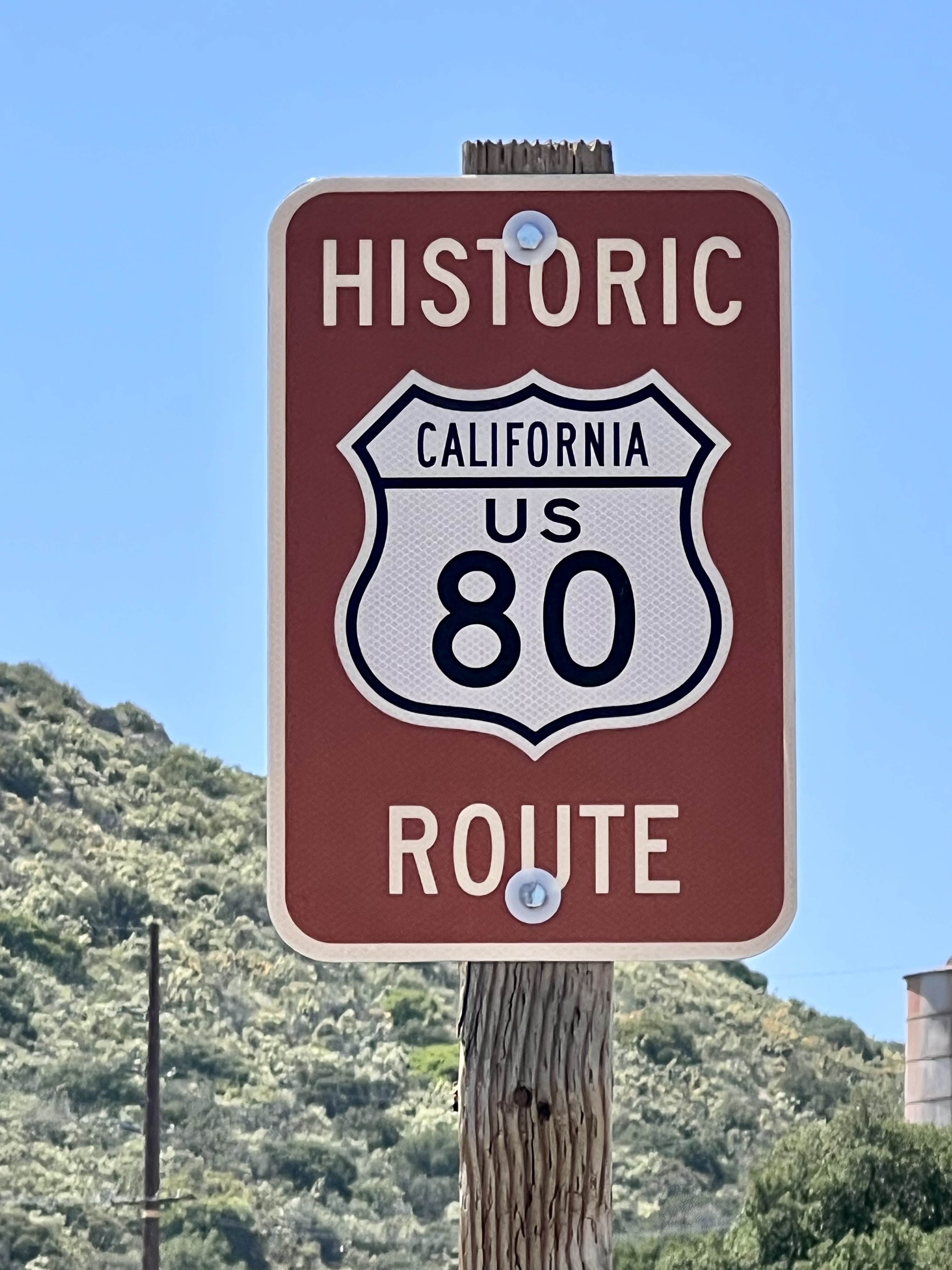
'Welcome to Jacumba Hot Springs, population 561'. I was on the Historic California US 80 Route. I saw a sign for a restaurant, but the establishment was closed and being rebuilt. Nothing in town seemed open. I stopped at the Mountain Sage market and bought a can of Rosarita traditional refried beans, Duchess frosted donuts, and a Brisk raspberry iced tea. I sat out front on the curb and charged my phone and rear tail light.
As I was riding out of town two dozen motorcycles passed me going in the other direction. The highway was right next to the border wall, and I stopped to take a few pictures. A border patrol vehicle was sitting there in the shade, watching me. Railroad tracks went right up against the border wall running east/west, and a bike lane began on the on the highway. The shoulder was designated a bike lane with No Parking signs.
There were ginormous mounds of piled boulders to both sides of the highway, and I imagined one of them rolling down into the roadway. I passed a sign, 'Welcome to Bankhead Springs'. No population was listed and I didn't see any services. It wasn't listed on my map. A bee slammed into where my helmet met my forehead and stung me, and it hurt! I could once again see Interstate 8 to my right. It was still breezy, but not nearly as bad as it had been down in the valley. I could hear my music, and was using my large front chain ring. I passed McCain Valley Road.
Coming into Roosevelt I noticed that the Manzanita Diner had been burned to the ground. I stopped at the Mountain Top Market for a 33 fl oz. bottle Canada Dry Ginger Ale. There were no other services. It seemed like all of the mom and pop places like the Wisteria Candy Cottage, had gone bust when the Interstate came through. Before I left, I removed my gilet and left my jacket on. It was 62°F and sunny, and I was still climbing. My weather app indicated a 17 mile-an-hour headwind. Andy wondered whether I was dealing with the Santa Ana winds, but they affect the coast and occur between September and May. I was twenty miles from Pine Valley.
I finally made it to the top of 3,890' Tecate Divide, and the wind was still strong. I entered Live Oak Springs, and noticed more wind farms. I kept climbing to up over 4,000'. The air was cool and I still had a headwind. At 4,100' I passed the Golden Acorn Casino. I took a left on Historic Highway 80 and enjoyed a fantastic descent through boulder strewn mountains and valleys. It was starting to look like the Southern California that I was familiar with. I descended over seven hundred feet and entered the Cleveland National Forest. There were now trees with leaves, and the desert was behind me. I passed the Boulder Creek Campground and saw another Border Patrol vehicle.
I began another climb, and was getting hot so I pulled over. I removed my jacket, applied sunscreen, and donned my arm protectors. While I was climbing, I could hear a creek flowing to my right. The Interstate was a quarter-mile to my right. Historic Highway 80 was two-lane with a four foot shoulder. I kept climbing and passed a Border Patrol station that was closed. I then passed Glencliff Fire Station, which was part of the Cleveland National Forest. A helicopter flew over from the west and I crossed a cattle guard.
I made my way to the top of 4,055' Laguna Summit and crossed Interstate 8. I kept climbing. Today was a big climbing day. I took a left onto Old Highway 80 and enjoyed the fragrance of flowering bushes. Signs indicated that I was in a bike lane and on a bike route. I entered Pine Valley and the Pine Valley House was closed. My only food option was Frosty Burger. I ordered a Mountain Cheeseburger, French Fries, a chocolate shake, and a root beer float. It was getting chilly and I donned my jacket before I left.
I enjoyed a nice descent out of town, and then I began climbing again. Ostensibly this was my last climb before the descent down to the coast. I was in a horse country and could smell the animals and their manure. In Guatay I ascended back over 4000' elevation. I passed the entrance to Cuyamaca State Park and saw a sign 'Alpine eleven San Diego forty-seven'. I had pedaled fifty-three miles. I wondered to myself whether I should spend the night up in these beautiful hills or ride all the way down to the coast.
I rode through the hamlet of Descanso and was now on State Highway 79. This was a really pretty area. I climbed another hill and got back onto Interstate 8 heading towards San Diego. I began barreling down a massive downhill and saw a sign '6.5 grade downhill next ten miles'. I crossed over the Sweetwater River, and passed a sign, 'Elevation 3000 feet'. I took Exit 36 and got on two-lane Alpine Boulevard where there was no shoulder and not much traffic.
'Welcome to Alpine, population 14,236'. 'Leaving Cleveland National Forest'. The hamlet of Alpine seemed pleasant and touristy. It was in sharp contrast to the desert. I stopped in front of the Town Hall, established in 1899, and flipped my map section to panel number one. Ocean Beach San Diego was thirty two miles ahead and I decided that I would be going for it.
I had a bike line on Alpine Boulevard as I sped downhill. I was now at sixteen hundred feet elevation. I noticed signs that I was following an evaluation route west to San Diego, and was wondering what the evacuation would be from. I crossed under the interstate and took a left back on Old Highway 80. I was still descending, and noticed small pleasant houses with beautiful flowers to both sides of the road. I crossed under the Interstate again and was now on Highway 8 Business. There were three lanes of motor traffic including a center lane for passing with bike lanes on both sides of the highway. I was down to six hundred feet elevation.
I took a right on Los Coches towards Lakeside, and a then a left on Julian. Next I went right on Channel Road. There were gray clouds in the sky, as I rode my way around Lakeside population 20,648. I took a left on Magnolia headed for Santee, population of 93,413. I then took a right on Mast Blvd. The terrain continued to roll up and down. I was surrounded by large grass hills and was still at three hundred and sixty-four feet elevation. Two military helicopters flew over me as I crossed over Santee Lake Bridge. I took a left on West Mills Parkway.
In addition to all of the housing developments and sprawl, there were still open fields and rugged mountains. I cut through Mission Hills Regional Park Road alongside the San Diego River. I shared the Father Junipero Serra Trail with people out walking, running, and exercising their dogs. As I rode through the narrow canyon, it was hard to believe that I was right outside of San Diego and fifteen miles from the beach. I took a right on Mission Gorge Road and then cut around through Grantsville. I eventually found myself on a trail adjacent to the San Diego River. A brown bunny jumped out in front of me. I turned on my front lights before I left the trail, and then rode by the Town & Country Convention Center and the Riverwalk Golf Club.
I entered another trail through the Mission County Preserve and two skunks crossed in front of me. The trail followed the San Diego River, which began to smell like a sewer and became swampy. I crossed under several Interstate exchanges and some of the underpasses were dark and sketchy. There were homeless people, some of whom had shopping carts while others had bicycles. I also noticed tents. As I neared the coast I saw signs for Sea World. I noticed a roller coaster on the horizon.
The sun was setting as I arrived at the beach. Three friendly women welcomed me and took a video of my front tire dip. I had finally completed the Southern Tier. Part one had begun April 11, 2021 in St. Augustine, FL with my dog Blanka. Part two had begun April 26, 2022 in Ocean Springs, MS. The total tour mileage was 3329. I had now earned the Triple Crown of American Long Distance Cycling.
 |
| The windswept slab out back of the Red Feather Off-Road Market & Cafe in Ocotillo. |
 |
| Arizona bark scorpion that had slept under my tent. |
 |
| Semi truck that had blown off the road on on Interstate 8 west of Ocotillo. |
 |
| My first time seeing the bottom of one of these. |
 |
| Wind is a plentiful resource here. |
 |
| Cement water tanks are spaced along the climb out of Ocotillo. |
 |
| The Jacumba Mountains climbing out of on Ocotillo on Interstate 8. |
 |
| Stuffed animal tree along Interstate 8. |
 |
| Desert View Tower in Boulder Park. |
 |
| Jacumba Mountains. |
 |
| Smuggling signage along the border. |
 |
| Breakfast at Mountain Sage market in Jacumba |
 |
| The border wall outside of Jacumba. |
 |
| Tecate Divide |
 |
| Historic US Highway 80 |
 |
| Lunch at Frosty Burger in Pine Valley. |
 |
| Lunch at Frosty Burger in Pine Valley. |
 |
| Tire dip in Ocean Beach, CA |
 |
| Map / Elevation Profile |

Comments
Post a Comment