Southern Tier Part 3 - Day #3 Hillsboro, NM to Forks Campground - Gila National Forest, NM
Southern Tier Part 3 - Day #3
May 27, 2023
Hillsboro, NM to Forks Campground - Gila National Forest, NM - 77 Miles
Start 7:09 PM Finish 5:43 PM
Total Duration 10:33
Moving Time 8:13
Stopped Time 2:21
Ascent 6836'
Descent 6529'
Tour Total 216 Miles
Details at: https://ridewithgps.com/trips/122723323
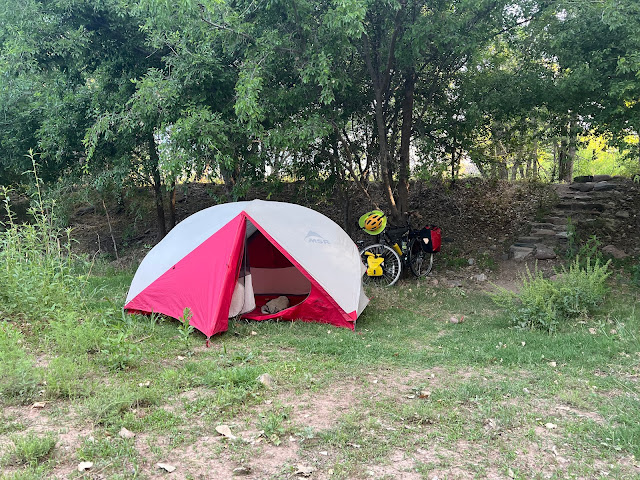
I slept well in Hillsboro Community Campground alongside NM Highway 152. It got cold during the night and I had to climb into my sleeping bag. It was a slow pack-up this morning and I made use of a nearby picnic table. I stopped back at the winery to use their Wi-Fi from out front. I also cleaned my sunglasses. The next door cafe wouldn’t be open for another fifteen minutes, and I decided to start pedaling up towards the pass. I was wearing my cycling shorts, short-sleeve jersey, gilet, and jacket. Kingston was nine miles ahead to the west and Silver City was fifty-eight.
Today was Saturday May 27th, the day I had originally planned to start the tour. Michele had changed her plane reservation to get home in time for her daughter's arrival from Germany. With three extra days on my hand I had decided to take the alternate route to visit the Gila Cliff Dwellings. My phone and GPS had been fully charged from my battery pack, and I regretted not being more assertive last night at the winery. I had been unable to spot an available outlet and I should have asked. My power pack was down to 78%.
I passed a highway sign that read, 'Road not plowed at night or on weekends'. I stopped to admire a steel truss bridge that had been constructed in 1927 to span Perch Creek. The Black Range Highway was now State Highway 152. I was getting warm and removed my jacket. I had been warned last night that there were still large rocks in the middle of the road that I would need to keep an eye on. This quickly became apparent. I'd been seeing beautiful wild flowers since the tour began, and finally stopped to take a few photos. I needed to give my Crazy Guy follower Bill some identification work to do.
As I climbed, the scrub morphed into coniferous trees. I passed a sign for the Kingston Campground and then crossed a cattle guard. I was on the New Mexico Birding Trail. I entered Kingston, no population listed, elevation 6146', and established in 1882. I rode into town and and was disappointed not to find any services. I stopped to admire the handsome old Perch Bank. Last night I had learned that gold deposits had been mined to the east of the pass and silver to the west. I rode back back out to the highway, and continued climbing. It would be eight more miles to the top of Emory Pass, and Silver city was forty-nine miles to the west.
I entered Gila National Forest, and the gate was open. A sign read that fire danger was moderate. Five miles from the pass I pulled over for a water and pecan break. I turned on my rear light and radar. The roads were curvy and there was sporadic motor traffic. At 10:15 AM I reached the summit of 8228' Emory Pass, the highest point on the Southern Tier route. I entered the Mimbres basin watershed and the Grant Soil and Water Conservation District.
Coming down the other side I rode through a narrow gorge that followed a creek. I was surrounded by trees and rock outcrops, and it was breathtaking. I passed an open gate and left the Gila National Forest. I stopped to flip my map panel. Small buildings began to appear as I entered San Lorenzo. I took a right on State Highway 28 for the Gila Cliff Dwellings Alternative Route. There were gray clouds in the sky and it was windy.
I stopped at Restaurant El Sol where I ordered huevos rancheros with lemonade. At the table I charged my devices and posted on social media. Before leaving I filled my water bottles, including ice and soda water in my insulated bottle. It was now hot and sunny so I removed my gilet, lathered with sunscreen, and donned my arm protectors. Before pushing off I plugged in a Duane Train episode. The next town was Mimbres, population 667. I passed a waterfall coming out of the rocks, and the source was ostensibly the Bear Canyon Dam. Five miles down the road I stopped for a Coke at 4 Seaysons Country Store.
Back out on the road I entered back into the Gila National Forest. I came to the turn-off for National Forest Road 150 and intersected with the ACA Great Divide Route Section 6. I had bypassed this section last summer because of the forest fires. I crossed the Continental Divide to the Pacific side, my first continental divide crossing on the Southern Tier. I passed a welcome sign for the Trail of the Mountain Spirits Scenic Byway. A fantastic valley opened up in front of me.
A female day cyclist passed me going the other direction as I rode around Lake Roberts. A sign out in front of the Lake Roberts store read 'Last Chance to Buy Beer!!!'. There was a guy sitting out on the porch playing guitar. I purchased a six pack of Grumpy Old Troll IPA and two cans of Mixed-UpRita Classic Margarita Cocktail, a ten pound bag of ice, along with a bag of Fritos, a Drumstick Vanilla Ice Cream Cone, and a Brisk Iced Tea.
I took a right on State Highway 15, also known as Clinton P. Anderson Road, towards the Gila Cliff Dwellings National Monument. It was a long, slow climb and the heat was melting my ice. It was slow going and I stopped to take several breaks. I relished my cold soda water that I had gotten at Restaurant El Sol. I stopped at Copperas Peak, and could see a fire to the north from the overlook.
I went screaming down a monstrous long hill that I knew I'd pay for on the return tomorrow. I enjoyed extraordinary views of gorgeous rock outcrops, as I rode down to and then crossed the Gila River, which forked right before the campground. At Fork Campground I scouted a way down to the west fork of the river. There was a fantastic rock formation, and a waxing half moon had appeared in the sky. Spanish-speaking families were playing in the water, as I sat at river's edge drinking margaritas and beer while I edited this report.
 |
| Hillsboro Community Campground |
 |
| steel truss bridge constructed in 1927 to span Perch Creek |
 |
| evening primrose |
 |
| antelope milkweed |
 |
| caterpillar in the family of Noctuidae (the hairs can cause a bad rash) |
 |
| jimsonweed (toxic) |
 |
| The Percha Bank in Kingston, NM |
 |
| 8228' Emory Pass, the highest point on the Southern Tier |
 |
| Waterfall from Bear Canyon Dam |
 |
| First Continental Divide crossing |
 |
| Never let an opportunity pass you by |
 | ||
Gila National Forest
|


Comments
Post a Comment