Southern Tier Part 3 - Day #5 Tyrone, NM to Twin Knolls, AZ
Southern Tier Part 3 - Day #5
May 29, 2023
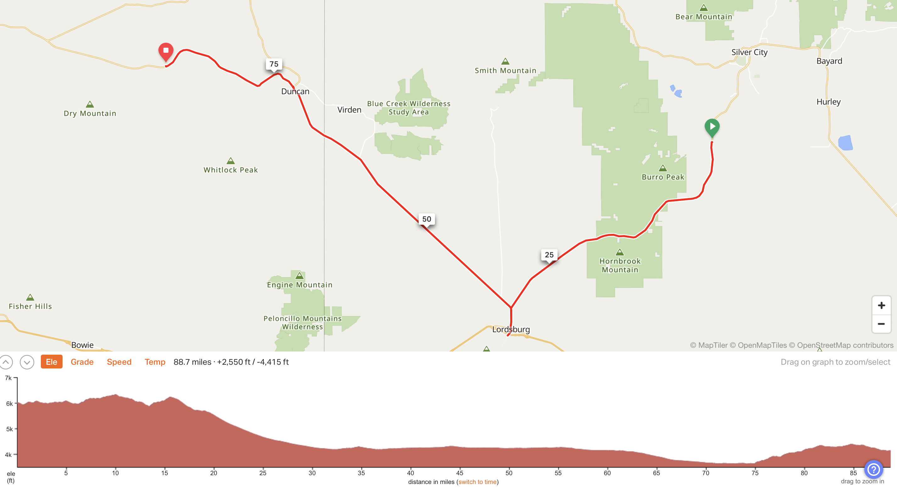
Tyrone, NM to Twin Knolls, AZ - 89 Miles
Start 7:22 PM MDST Finish 6:09 PM PDST
Total Duration 11:47
Moving Time 7:17
Stopped Time 4:30
Ascent 2550'
Descent 4415'
Tour Total 368 Miles
Details at: https://ridewithgps.com/trips/122835760
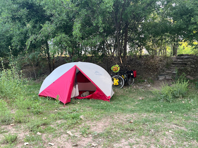
I slept well stealth camping in the scrubby dirt cow pasture on the other side of the fence from the highway. I set up in the dark underneath a half moon with the stars blazing. I found a nice smooth spot, and spent some time looking for goat heads and other prickly things that would puncture my Thermarest. I noticed a large earthen scar to the north. I had one bar of service and tried to upload the last two days worth of stats. I failed on all sites except Strava. I inadvertently slept with my sleeping bag inside out. It didn’t get extremely cold last night, and there were faint murmurs of motor traffic from the highway. I woke up with the sun. I had dreams about skiing in Brooklyn with the Century Plus Crew. It was a slow pack-up, and I enjoyed my Starbucks Frappuccino and a pack of Donettes on my tarp. Today was Memorial Day.
The large cut across the highway appeared to have been man-made, and I suspected it was a mine. There had been an entrance down the road that I passed last night, but I didn’t connect it with something so massive. I made a short time-lapse video of hopping back over the gate to the highway. Afterwards I had to return back over the fence to get my phone, proving that people always return to scene of the crime.
In addition to the usual I was wearing my gilet. There wasn’t a cloud in the sky and I doubted that I would have tree cover today. It was going to be a hot. My plan was to make it to Duncan where I could spend the night in the city park. There would be a stop midway at Lordsburg, which would be off-route. Tomorrow, because of a lack of services, I was planning to ride a century.
The sun was still low and the birds were chirping. I rode through fields of grass, weeds, and wildflowers peppered with prickly scrub. There were occasional cattle, and the landscape was divided by barbwire fencing and utility poles. I noticed very little motor traffic on State Highway 90. After five and a half miles I entered White Signal, no population listed. I stopped at the turn-off for Separ Road, which I had ridden last year on the Great Divide coming from Hachita. This was where Trayvon had broken his collar bone, and I had found local ranchers to help. It was great being back on the Divide these past two days. From here going west it would all be all new territory.
I was loving my new Oakley sunglasses which had been worth every penny. My field of vision, including maps and devices, was crystal clear. They adjusted with the light so I could use them day or night. My former touring eye-ware was insufficient and uncomfortable.
After ten miles of pedaling I crossed the Continental Divide at 6355' elevation. From here going west the drainage would be towards the Pacific. The sign was surrounded by sticker bushes and I recalled other times I was pricked or stung while documenting a highway sign. Afterwards I removed my gilet and plugged in a Duane Train episode.
I stopped to read a historical marker regarding the McComas incident, and settlers who were killed by Apaches during the Indian wars. A formation of four military helicopters flew over me heading Northwest. At C Bar Ranch Road I crossed the Continental Divide Trail. I climbed up over a rise, and could see dozens of miles to the west. There was haze in the valley ahead, but the visibility was clear where I was.
I crossed the Hidalgo County line and left the Gila National Forest, I hadn’t realized I was still in the forest. The Gila is special and I was thankful to spend some time there. I entered a ginormous valley, which reminded me of the Western Express through Nevada. I could see Lordsburg twelve miles away. As I was flyings down the road, I nearly hit a toad that was trying to cross the highway. I then clocked a lizard running alongside the road at fifteen miles an hour.
At Thompson Canyon Road the highway cut south towards Lordsburg, which I could see ahead situated against a dirt mountain. I was finally able to spot Interstate 10. I came to the junction of US Highway 70, which I would be taking west to Duncan after my break in Lordsburg. The town and services were east on US 70 and two miles off-route.
I entered Lordsburg population 3379, elevation 4245' and founded in 1880 on the route of the Southern Pacific Railroad. I noticed an Amtrak train traveling east as I was pedaling into town. Lordsburg had seen better days. All of the downtown businesses were shuttered and for sale, so I rode out to the Interstate for a restaurant. The Lordsburg Memorial Park featured bronze statues of military officers. Banners portraying the local 2023 high school graduates were hung from utility poles.
Cranberries restaurant wouldn’t be open for another forty-five minutes, so I went to Los Victors Mexican food across the street. Los Victors was rather jenky, but Cranberries seemed touristy. I ordered five rolled tacos with carne asada along with two large Sprites. I took a birdbath and cleaned my privates in the restroom. I ran down my phone battery using it as a mobile hotspot to get my stats uploaded. Afterwards I rode out of town and back to the route. My destination, Duncan, was thirty-six miles to the west. It was 11:15 AM.
I pedaled back out to the junction with State Highway 90 and then continued northwest on US 70. I was now on the 'Old Country West Trail'. My orientation to the northwest was straight into the wind and the heading was for sixteen miles. I came to the junction of State Highway 464 and kept going straight. I came to the junction of Cap Rock Ranch Road and was sixteen miles from the Arizona border. It was 12:30 PM and my right eye was burning, which was where my bandanna came in handy. A wide smooth shoulder opened up, and I took advantage of it. I occasionally got caught in the jaw rattling rumble strip.
Ten miles east of the border I stopped to enjoy the remainder of my cold water from my insulated bottle. I noticed that the bottle on the lower tube was rubbing against my front tire and I would need to find a piece of rope to secure it. There was no shade today. A greyhound bus heading east towards El Paso drove past me. The road elbowed to the northwest and the wind was now blowing my left shoulder instead of straight on. I passed the Lazy B Ranch to my left. I came to the junction of state Highway 92, which led north. I noticed a formation of three helicopters flying over me heading northwest.
I crossed into Arizona, the seventh state on the Southern Tier route and the newest and thirty-sixth state that I'd cycled. It’s a tradition on American coast-to-coast bicycle tours to take a naked selfie in front of a state border midway on your route. I obliged, and the ground was so hot that my feet were scorched on the pavement. After three photos it was time to call it quits. Another squadron of helicopters flew over me heading northwest.
Arizona doesn’t recognize daylight savings time and I noticed that I was now in Pacific time. I was four miles from Duncan, forty-five from Safford, and a hundred and twenty-three from Globe. I rode through Franklin, no population listed and no services. I was joined by a pair of railroad tracks to my left. I crossed over Railroad Wash, and passed a sign that read that I was on the 'Old West Highway'.
I entered Duncan, population 765, elevation 3660', and founded in 1880. I stopped at the Ranch House which advertised family fare. I was looking for beer. I had ridden through town and the River Front Lounge and Bonnie Heather Inn were both closed. I checked out the town campground and returned to the Ranch House. I noticed that there was a bar in the back, where I found a table and plugged in my devices. I ordered several Dos Equis with limes, along with a bacon cheeseburger with curly fries.
I stopped at a Quick mart for a six pack of Dos Equis, two bags of Fritos, a bottle of Starbucks Frappuccino, and a pack of Hostess Donettes for the morning. I also grabbed a bag of ice. The plan was to do twenty more miles. Safford was thirty-eight miles ahead and Globe was a hundred and fourteen. My devices were charged and my water bottles were full. I now had a strap around the lower water bottle so that it wouldn't rub against the front tire. It was 91°F with eleven mile-an-hour winds out of the south/southwest.
It could have been my imagination, but Arizona seemed more redneck and conservative than laid-back New Mexico. New Mexico lives up to it's name. It really is the land of enchantment. I hope to return some day, to explore more of it.
The sun kept moving in and out of the clouds. It was hot and my bag of ice was melting. I decided to shift things around and put the ice in the rear pannier along with the beer. After fourteen miles I entered Graham County. It was 5:41 PM Pacific Daylight Time. I crossed over Short Tank Wash. I was riding past 4208' Twin Knolls to my right.
I had ridden almost ninety miles, which was my plan. I was looking for a gate to hop, and spotted a water tanker truck sitting out in the middle of a field. The gate was easily unlocked, and I rolled in. I popped open a cold beer and uploaded my stats. The insects were plentiful, and I sprayed my legs with repellent. Small bugs continued trying to climb down into my left knee wound from El Paso, so I filled it with Cortizone and sprayed some extra insect repellent for good measure.
Once the sun went down, I sat up on the water tank and enjoyed a fantastic sunset. Far to the west
I could see Safford.
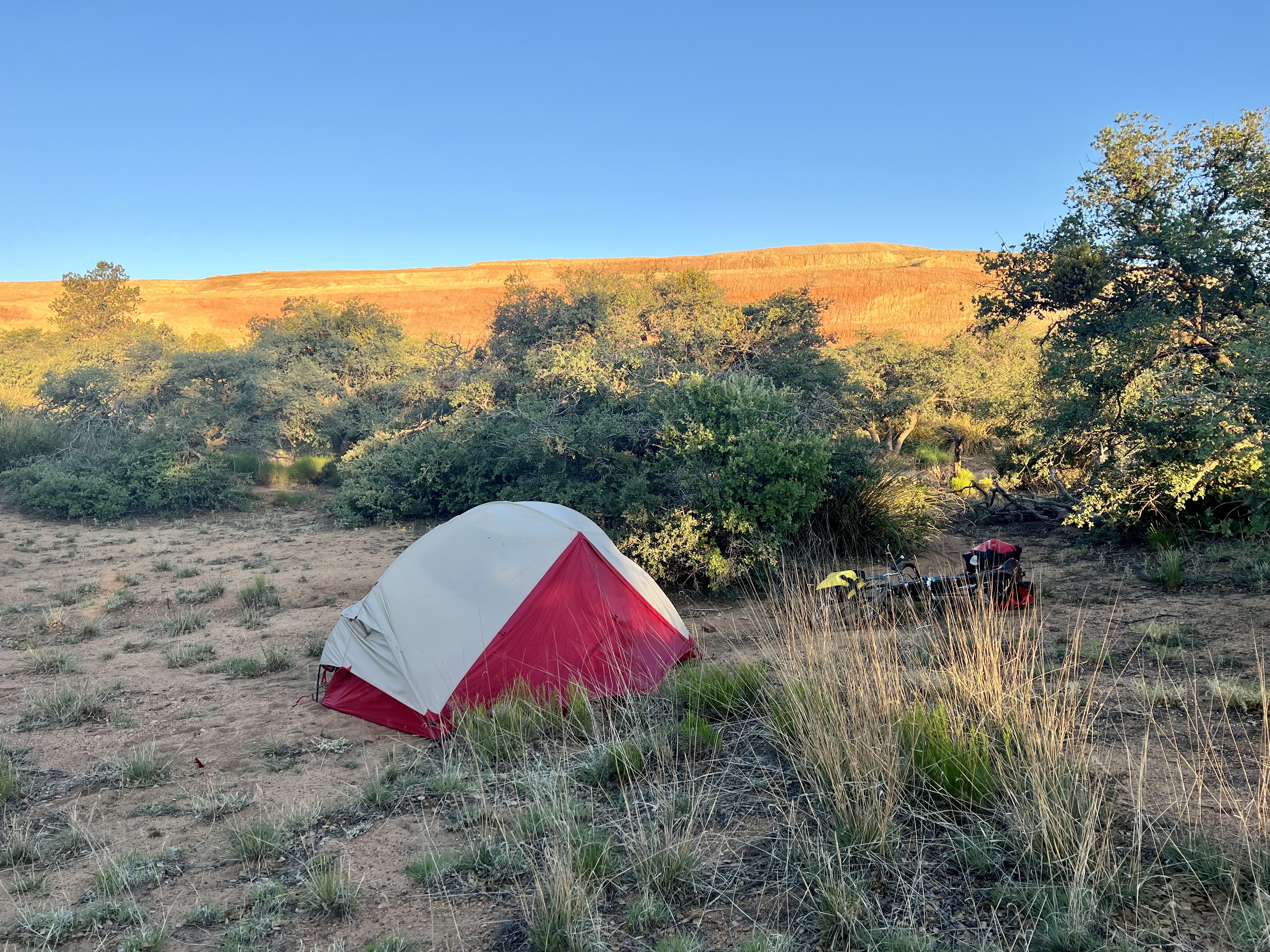 |
| Stealth camping in the cow pasture |
 |
| Breakfast of Champions |
 |
| Pacific drainage from here going west |
 |
| Southwest New Mexico |
 |
| Breakfast Tacos at Los Victors |
 |
| Los Victors, Lordsburg, NM |
 |
| Lordsburg Memorial Park |
 |
| Southwest New Mexico |
 |
| Southwest New Mexico |
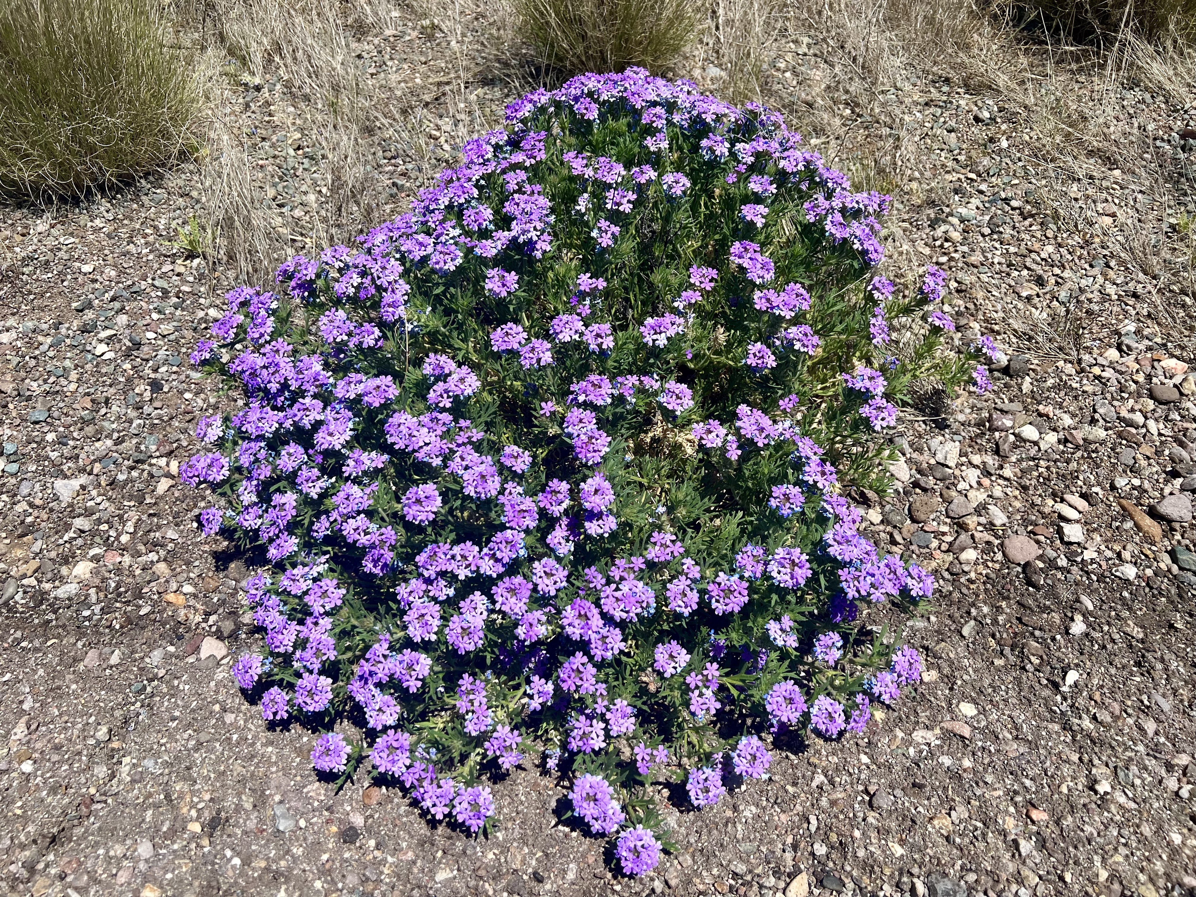 |
| Sand Verbena |
 |
| Old windmill and water tank |
 |
| Arizona! Seventh state on the Southern Tier |
 |
| Duncan, AZ |
 |
| Wild camp spot for the night |
 |
| Sunset and star gazing perch |


Comments
Post a Comment