Southern Tier Part 3 - Day #8 Sycamore Creektrail, AZ to Phoenix, AZ
Southern Tier Part 3 - Day #8
June 1, 2023
Sycamore Creektrail, AZ to Phoenix, AZ - 72 Miles
Start 6:49 AM Finish 4:00 PM
Total Duration 9:11
Moving Time 5:59
Stopped Time 3:11
Ascent 2239'
Descent 3418'
Tour Total 630 Miles
Details at: https://ridewithgps.com/trips/123157651
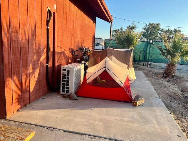
I slept well last night wild camping alongside Sycamore Creek south of Sunflower, AZ. It was warm when I went to bed but it quickly got chilly. I had to unfurl my silk liner and later my sleeping bag. This morning I let myself sleep in. There were loud birds squawking outside my tent. It was 6 AM when I got up, and the traffic from the nearby highway was loud.
There was no breakfast this morning, but I had a large rock that I could sit on for a moment before departing. I rode out to the highway and took a right on State Highway 87 a.k.a. the Beeline Highway. I was wearing my short-sleeve jersey and cycling shorts. It was a little chilly but the sun was strong. I crossed Camp Creek, and there were saguaro cactus everywhere. I realized that my rear light wasn't on, so I stopped to activate it.
I crossed Mesquite Wash and then began a ginormous long climb. State Highway 87 was four lines divided like a freeway. There was a state trooper stopped ahead on the shoulder with lights blazing. Mesa was thirty-three miles ahead. I finally caught up with the patrol car. The trooper was aiding a carload of folks from Oklahoma.
After twenty minutes of climbing covering two miles, the grade began to mellow. I enjoyed a brief one mile descent and then began climbing again. The highway had a nice wide shoulder to the right of the rumble strips and white line. I rode on the shoulder when it was clear and not full of glass. I passed the turn-off for Sugarloaf Mountain.
From the top of the second ascent, I could see a huge valley ahead with structures, which I assumed was Mesa. At exit 199 I left the highway and took a left on Bush Highway. There was a cloverleaf junction and an overpass over the highway, and I exited highway 88 like a car would do on an interstate.
Bush Highway was two-lanes of motor traffic and a sign read to watch for horses for the next nine miles. I was in the Tonto National Forest Recreation Area, Lower Salt River. It was gorgeous with fantastic sculpted rock outcrops and giant boulders, and replete with saguaro cactus. There was heavy motor traffic going in the other direction, but virtually none on my side. Only twelve inches of shoulder sat to the right of the white line, and beyond that was chunky rocks and dirt. I rode to the left of the white line.
After a small climb, I had a fantastic gorgeous descent into the Salt River Valley. I was now in a designated bike lane, and I waved to an oncoming day cyclist. I crossed over the Salt River and could see fly fisherman below. They were doing road work and I came to a flag person whom had stopped traffic. A day cyclist passed going the other direction.
I met up with local cyclist Dan and his female companion. They were cycling back towards Mesa, and he recommended First Watch for breakfast. He mentioned that they had cycled cross-country following much of the Trans Am. I was loosing my breath trying to keep up with their pace, and Dan's companion stayed way ahead. They took a left and I kept going. I later realized that I should have taken the same left, and I had to return to Usery Pass Road.
I had one more climb before Tempe. I noticed a parking lot on the side of the road where a mountain biker was strapping up. Another cyclist was bombing down the hill. I passed another trail head with more mountain bikers. At the top of the 2115' pass I stopped to finish my water. I could hear people shooting rifles at nearby Usery Mountain Shooting Range. Up on a hillside I noticed Phoenix was written in rocks with an arrow.
I entered the sprawl and stopped to plug in my phone, which was almost dead. I crossed over an irrigation canal and took a right on University Drive. After a mile and a half I took a right on 80th St. I was riding through the suburbs and noticed that most people had gravel in their front yards. Some public areas had green grass. I took a left on Adobe Road, and rode through a medium income community with modest homes built in the seventies. Some of the yards had green or brown grass, but most had different types of gravel or crushed stone. Properties featured pine trees, palm trees, cactus, bushes, and colorful flowers.
There was a substantial focus on water here, and I noticed numerous canals, ditches, pumping stations, and large valves alongside the road. I also observed carports that could shade motor vehicles from the blazing sun. I ended up on Sixth Street heading west towards Tempe. Then I took West 8th Street, which featured bent street lamps that I found striking. I rode by the Mesa Riverview Park, and then the Sloan Park Cubs Baseball Field. I crossed underneath the 101 Freeway Loop and entered Tempe. I was parched, and desperately needed something to drink. I rode through the campus of Arizona State University, and noticed eScooters and trams. I spotted a driverless WeMo, and then I saw another one.
Aside from an old concrete grain elevator, I found the new architecture cold and synthetic. That said, I loved that there was a small mountain in the middle of the town that everything conformed around. I wasn't able to find a place to eat or stay so I flipped to Southern Tier map section #1 and rode across the Salt River towards Phoenix. I took a right on Curry Road and passed giant rock formations and a desert landscape.
I took a left on College Road riding around Papago Park, and then entered Scottsdale, 'the most livable city'. The outside edge of my left foot was sun burned from an opening in my sandal. It had been directly facing the sun, and I stopped to apply sunscreen. I was riding without arm protection today and hopefully wouldn’t pay a price.
I took a left on Oak Street and circled around the Phoenix Military Reservation. I passed more spectacular rock outcrops. I went up over a saddle and could see the Phoenix skyline in the distance. Check-in at the hotel wasn't until 3 PM so I went to the Tombstone Brewery where I ordered a pint of Spawn of Earp and the couscous paella.
I checked into the Hampton Inn room 241 and did my laundry and took a shower. I edited reports and got caught up on my email and social media. I rode over to Sun Up brewery which was closed. I then went to Huss Brewing Company Uptown, where I enjoyed several pints of their Juicy Juicy along with a Cubano and chips and salsa. I had accidentally left my rear light charging at the hotel and had to ride back to the hotel with only a front light.
 |
| Wild camping alongside Sycamore Creek |
 |
| Tonto National Forest |
 |
| Road construction on Bush Highway |
 |
| Phoenix spelled in rocks, ostensibly for lost aircraft |
 |
| Welcome to Tempe! |
 |
| The Tempe street layout conforms around a small mountain in the center of town |
 |
| Map / Elevation Profile |


Comments
Post a Comment