Southern Tier Part 3 - Day #10 Wickenburg, AZ to Quartzite, AZ
Southern Tier Part 3 - Day #10
June 3, 2023
Wickenburg, AZ - Quartzite, AZ 86 Miles
Start 6:43 AM Finish 7:52 PM
Total Duration 13:09
Moving Time 7:10
Stopped Time 6:00
Ascent 1079'
Descent 2721'
Tour Total 796 Miles
Details at: https://ridewithgps.com/trips/123455802
I slept well last night wild camping on Arizona State Trust Land, off the side of of US 60 and just north of the Vulture Mountains. It was warm last night when I first got into the tent, and I left one flap open. I eventually needed my silk liner and later my sleeping bag. I woke up with the sun and got up at 5:20 AM to water a bush. I was about an hour's ride from my first service stop and saw no point in leaving before 7 AM. I tried go back to sleep and eventually got up at 6 AM. The area was full of bees and there was static electricity on the tarp. A car had gone by on the gravel while I was still in the tent, and another one passed while I was packing and we waved.
I got my gravel on cycling back to the highway, and these tires definitely weren't meant for it. A pick-up truck was parked up ahead and a big white dog came bounding towards me barking. I could tell he was friendly, and his human bid me a 'Good morning!'. I crossed the cattle guard and took a right on US 60, and then stopped to turn on my flashing rear light and radar.
I was wearing my cycling shorts, short-sleeve jersey, and socks. It was 72° F and forecast to go up to 92° F with the chance of thunderstorms later in the afternoon. There were four mile-an-hour winds from the north/north west, and it felt stronger than that. I passed more beehives to the right of the highway. I passed a sign that read Aguila fourteen, Quartzsite seventy-nine, Los Angeles three hundred twenty-six.
I was on a perfectly straight section of highway heading west for twelve miles across the desert alongside a double set of high voltage lines. On my paper map US 60 was also labeled as bicycle route 60. I hadn’t noticed any bicycle route road signs. I passed a small settlement with houses, trailer homes, stables, corrals, and horses. Despite the wind, I was pedaling seventeen miles an hour. I do well on flats, and I had a slight descent.
I passed 453 Avenue and noticed a settlement of houses to my right. My nose had been stuffed up this entire tour. I'd either had a cold or allergies. I've been doing the cowboy nose blow and my voice has been gravelly. I passed Forepaugh Cattle Company to the right, and found the name strange. Shouldn't it be four hooves? I could see Aguila from eight miles out. I was in a perfectly flat valley with mountains to north, northwest, and southwest. I was in the Aguila Valley and noticed expansive cultivated fields to my right. Cultivation then began to my left and I noticed pumping stations. I was curious and finally pulled over to investigate. They were growing cantaloupes. There were also bee hives for pollination. I passed a sign that read, 'California ninety-seven miles'. I’d be there tomorrow.
I came to the junction of State Highway 71, and shortly afterwards entered Aguila population 798. The Coyote Cafe was closed, and there was a food truck out front. It was a few minutes before 8 AM and the proprietor said they'd be open in a few minutes. He started up a noisy generator, and I sat on a bench on the porch. I was invited to place my order and then sit inside at a table. I ordered huevos rancheros and a lemonade and got caught up on the news. Two locals came in and sat at another table. My food was served in a styrofoam container, in a plastic bag takeout style. It wasn’t the worst huevos rancheros I’d ever had. Afterwards I used the bathroom and did a bird bath. There were more patrons seated when I left. I got my water bottles filled before I rolled out.
The cafe had been on the eastern edge of town, and I then rode through the center. Aside from the 76 gas station, everything was shuttered. The highway connected back up with the train line and there were tank cars on the tracks. I noticed grain elevators, and then rode out the other side of town. The next town, Wenden, was twenty-three miles away. Salome was twenty-eight. I was riding a straight line to the southwest, and there was nothing to either side of the road. I came to Gladden, which wasn’t listed on my map. There was a trailer and RV park. After more pedaling, I entered La Paz county.
I passed a warning sign to 'Watch for animals!'. Wenden was now thirteen miles ahead. On the approach I passed the cemetery, and then I crossed Centennial Wash. Wenden had a population of 728, and is the gateway to Lake Alamo. Once again, the railroad tracks met back up with the highway. I stopped at the Saguaro Market for a nice big cold Sprite on ice, served in a styrofoam cup.
After Wenden US Highway 60 shifted southwest. The railroad tracks were to the right side of the highway. The next town, Salome, was four miles away and I was planning to stop at Don’s Cactus Bar. Along the way I passed groves of pistachio trees. On the outskirts of town I passed the Stanford Inn and Cafe, the RV park, and Solome Market. I entered Salome, population 1530, elevation 1880', and founded in 1904.
Don‘s Cactus bar was pitch dark and filled with good ol' boys. The air-conditioning was refreshing. I had a bottle of Dos Equis with a lime wedge. It was early and the kitchen wasn’t yet open, so I decided to keep moving. I rode down through a nice canyon surrounded by mountains. The next town was Hope. I rode by the junction of State Highway 72. It was 92° F with five mile-an-hour winds out of the west/southwest, giving me a headwind. No population was listed for Hope and there were no services. I somehow managed to miss the 'Your Now Beyond Hope' road sign.
I rode past dirt, scrub, and mountains. I crossed over the Central Arizona Project aqueduct and noticed the Vicksburg mine. The next town was Vicksburg, population 597. There were no services and it was bleak. On the far end of town, Dos Amigos Mexican Restaurant 'serving cold beer and margaritas' was also closed. I was now riding through the Ranegras Plain.
I stopped at the intersection of S. McVeigh Road, and finished the rest of my cold water. I had seven miles of pedaling to Brenda. It was 95° F, blistering hot, and I was afraid my tires would melt. Movement and oncoming air kept me from overheating. I was trying to gauge where Brenda and I-10 were on the horizon, and I miscalculated. I would first have to ride past the Bear Hills. There was a dust devil to my right that shot straight into the sky.
I stopped at the Black Rock Cafe, the only service for miles, and started with a pitcher of lemonade. I ordered a BLT sandwich with cottage cheese, and later enjoyed a few Dos Equis. The air conditioner wasn't working and they were playing seventies music. It was blistering hot when I left, and I continued west under the blazing sun.
After a few miles US Highway 60 came to an end and the route led me onto Interstate 10. I had a headwind and could see that I had a five mile climb in front of me. The shoulder was littered with debris and semi trucks were barreling by. I noticed a wrench on the shoulder.
I finally reached the top of the climb and could see Quartzite four miles ahead. I pedaled against the wind and slowly made my way there. I took the first exit and rode into town. The welcome sign featured three camels and a pyramid. Later in town I noticed other representations of camels. I had Google searched Quartzite food options earlier in the day, and noticed that most closed at 6pm. Grubstake Social Club stayed open until 8pm and that was my plan. When I got there it was closed. It was 6pm and still hot. I just needed a place to sit down. I set off for a Carls fast food on the route and was pleasantly surprised to find that the Horney Toade was open. They had outdoor seating with tables, a buffet, and bar. The bartender was wearing cowboy boots a skirt, and a dog collar around his neck. I asked a local about the camels and was told that someone had tried to bring camels here to work back in the day, but it was unsuccessful. I enjoyed a dinner of pasta and rice lentils with spicy sauce and salad.
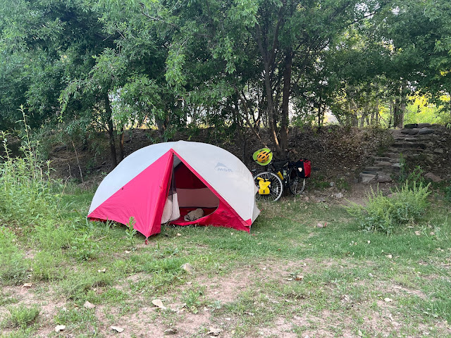
After the Horney Toade I crossed over the Interstate and continued west on Dome Rock Road. I spotted dirt tracks to my left and decided to check it out. I turned off my red blinking light and followed a track up away from the valley. I finally found a nice level surface where I could camp, although several large rocks needed to be moved to make it wide enough for my tent. The wind was strong and I needed my stakes to keep my tent in place. Quartzite could be seen down below in the valley along with the hill I'd ridden down earlier. Cars and trucks flowed down the Interstate, and lights glittered from the gas stations and fast food joints. It was a strawberry full moon.
 |
| Wild camping Arizona State Trust Land, off the side of of US 60. |
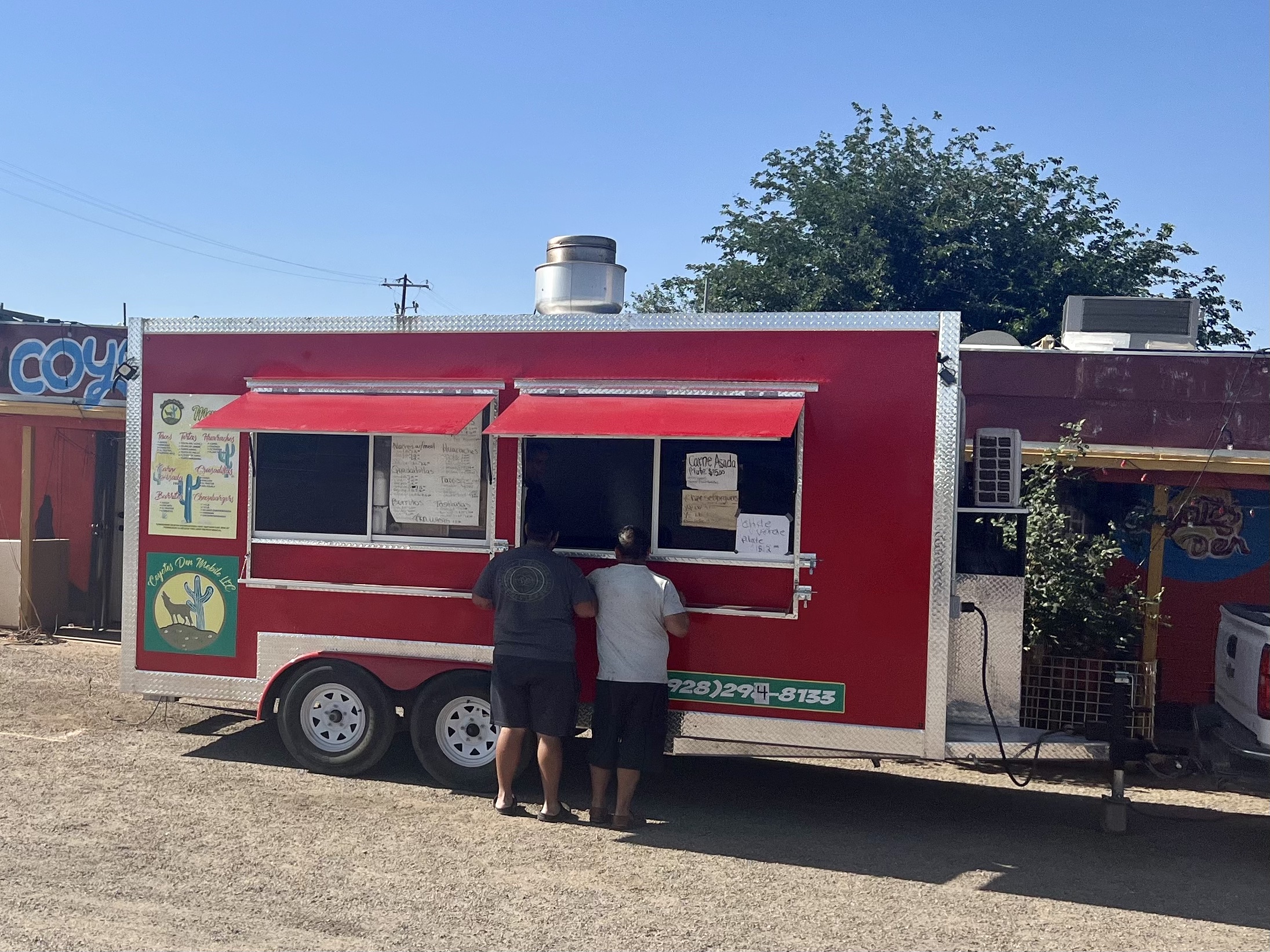 |
| Coyote Cafe in Aguila. |
 |
| Breakfast at the Coyote Cafe |
 |
| Wenden, AZ |
 |
| Hope, AZ |
 |
| Dust devil in the Bear Hills |
 |
| Hydrating at Black Rock Cafe |
 |
| BLT at the Black Rock Cafe. |
 |
| Quartzite, AZ |
 |
| The Horney Toade in Quartzite |
 |
| Bartender at the Horney Toade |
 |
| Map / Elevation Profile |

Comments
Post a Comment