Southern Tier Part 3 - Day #11 Quartzite, AZ to Orita, CA
Southern Tier Part 3 - Day #11
June 4, 2023
Quartzite, AZ - Orita, CA 100 Miles
Start 6:13 AM Finish 9:03 PM
Total Duration 14:50
Moving Time 9:09
Stopped Time 5:42
Ascent 2405'
Descent 3490'
Tour Total 896 Miles
Details at: https://ridewithgps.com/trips/123593060
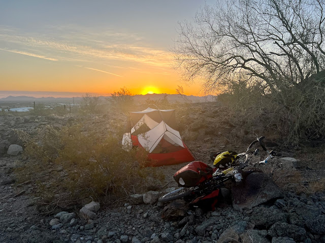
I slept fairly well last night wild camping outside of Quartzite and up towards the hills off of Dome Rock Road. It never did cool down and I slept with both tent flaps open. I laid inside on my Thermarest sweating. I dozed off but woke again at 1 AM. I could no longer take the heat so I got up, pulled up the stakes, wadded up my fly, and stuck it under a large rock. Back inside my tent, the bare mesh interior was much cooler. Later in the night I pulled out my silk liner. I had slept on a rocky surface and it was a slow pack-up in the morning. The gravel road was replete with baby head sized rocks and was tough to ride with my narrow tires. I finally made it back to the road and took a left heading west.
I noticed that there were people camping alongside Dome Rock Road and saw a sign that read 'Camping seven day limit'. It was 6:30 AM and the air was still cool and pleasant. The interstate was a mile to the north, and serrated mountains could be seen to the west, southwest, northwest and north. I’d been having problems with my right cleat, which wouldn't clip into the pedal. This would be the last tour for these sandals. I had a brand new pair waiting for me back in Brooklyn.
I rode past Dome Rock, and noticed numerous dirt tracks up into the hills. I crossed a cattle guard and then the road came to an end. I got on I-10 heading west and rode on a nice wide shoulder. I passed a sign that read 'Bicycles use shoulder lane'. I was fifteen miles from Blythe and entered the Colorado River Indian Reservation.
At the top of a climb, a huge wide valley opened up before me and I rode down into it. There were services at Exit 5, and I decided to just keep going. I descended further into the valley and found myself at 355' elevation, the lowest I'd been on the Southern Tier since Louisiana.
I exited the Interstate and got on Frontage Road. I stopped at a 76 gas station and purchased a large pink lemonade and some honey roasted peanuts. I continued down Frontage road and took the bike lane adjacent to the interstate over the Colorado River Bridge. I took a photo of the California sign and noticed jet skiers in the flowing green river below.
There was an California Agricultural Inspection Station for motorists on the Interstate. I was on Hobson Way and noticed alfalfa grass fields to both sides of the roadways, along with palm trees. I rode through the sprawl of Blythe passing the High Times Market, Blue Line Motel & Trailer Park, the Smoke and Vape Shop, Motel 6, AutoZone, and several gas stations.
I should have stopped at the Steaks n Cakes because, aside from fast food, all of the other breakfast places were closed. The downtown was largely shuttered, and most of the businesses were near the interstate. I kept pedaling and reached the alfalfa grass fields on the west end of town. I was noticing irrigation canals and saw a sign for the Blythe Municipal Golf Course.
I was in Riverside County California and passing large stacks of cargo container size bales of alfalfa grass hay. I rode by horse corals and took a photo of a pair of friendly fillies underneath some palm trees. At the turn-off for State Highway 78 I stopped at a Valero station for a large fruit punch and a pack of Hostess donuts. I joked to the clerk, 'Another healthy breakfast!', and she started laughing. I put on my arm protectors, plugged my phone into my charger and headed south on State Highway 78, aka South Neighbors Boulevard, as I crossed under Interstate 10.
There were alfalfa grass fields to both sides of the road. The next town was Ripley, population 692, and I could see the water tower from five miles away. Ripley was a farming community, with large grain elevators and farming equipment. There were no services and the J & M market was closed. A sign read 'Palo Verde ten, Glamis fifty, Brawley, seventy-seven. I kept my fingers crossed there would be services in these towns.
I took a right on 28th Avenue towards Palo Verde and Brawley while staying on California State Highway 78. I was riding alongside an irrigation canal and alfalfa grass fields. According to my phone there were four mile-an-hour winds out of the south, but it felt stronger. There were wind advisories of up to ten mile-an-hour winds today. All of my route today was southbound. By 10 AM I had ridden thirty-six miles.
I took another right, as I stair-stepped my way towards Palo Verde. I crossed over the Palo Verde drain, and then took a left. I rode into the town of Paulo Verde, population 171 and elevation 233′. The Palo Verde Bar & Grill was closed, as were other businesses, but I could see a Chevron sign in the distance. The weather forecast called for 103°F heat this afternoon and I stopped at the Chevron station. The soda machine was broken so I got myself a Strawberry Icy, and some Chavito Mexican peanuts. I sat outside in the shade and relished my frozen drink.
I continued south on State Highway 78 also known as the Ben Hulse Highway. According to Google Maps a store would be open in Glamis until 4 PM. Glamis was thirty-nine miles away. The following town, Brawley, was sixty-six miles. I would be going up over a pass between here and Glamis.
I crossed the Palo Verde Canal, which was brimming with water. It was hot and I pulled over under a bush for a drink of water. It was noon and I’d gone fifty miles. Glamis was thirty-two miles ahead and Brawley was fifty-nine. I came to the junction of Mitchells Camp Road.
I pulled over and sat in the shade of a palo verde tree. It was really hot. A motorist pulled over and circled back to see if I was OK. He asked me if I needed a ride and I declined. He then asked if I had enough water, I replied that I had some. I should have accepted every drop that he offered.
I passed the junction of Walters Camp Road and then Milpitas Wash Road. The sun was unbearable and I was running low on water. I found a shadow besides a small earthen bluff to take a nap. By 2:27 PM I had lost my shadow and headed back out on the road again. It was brutally hot. I took another break at the fifty-eight mile mark.
By 3:33 PM I had ridden sixty miles. Glamis was twenty-two miles ahead. I noticed an Imperial County Fire Truck on the side of the road alongside a motor vehicle. I stopped and asked for water. They gave me a bottle of warm and some cold to top off my chilled. I was crossing the Midway Mountains and there was no longer any tree cover.
I spotted a spring clamp on the side of the road. I stopped at the sixty-one mile mark to finish the rest of my cold water. Ostensibly there was a Border Patrol Station ahead where I could refill. Glamis was fifteen miles ahead and Brawley was sixty-four miles ahead. I pulled over again to drink some warm water under the shade of a tree. I passed a sign saying that it was a desert tortoise area.
The Border Patrol Station was closed, but I was able to find water from an outdoor spigot. I sat on a bench in the shade and relished the water. I came to the junction with Black Mountain Road. It was 100°F and I was at 1100' elevation. At the top of the pass, I could see massive sand dunes ahead. After more pedaling I came to the junction with Ogilby Road.
My rear light and radar was running low on battery, so I stopped to plug it into my charger. I had mistakenly left it on during one of my naps earlier. I rode by a barbwire and razor wire fenced-in area to the right, which encircled the Chocolate Mountain Aerial Gunnery Range.
I stopped and sat underneath the shade of a tree to finish my cold water. I was six miles away from Glamis and was completely exhausted. My energy was completely depleted and I decided to open up the can of refried beans that I'd been carrying since El Paso. I washed them down with warm water. I passed the junction for the road leading to the Mesquite Mine, and then saw the entrance to Equinox Gold, which was one of the largest gold mines in the United States.
From two miles out I could see a cell phone tower and some buildings in Glamis. And then I saw a long westbound freight train crossing the highway up ahead. There were ginormous sand dunes on the horizon. The train had gone through by the time I reached the tracks. I saw a large fox cross the highway right before the railroad crossing. The animal was a good size and had a big bushy tail. There wasn't much to Glamis, and I didn't see a soul. I stopped at the Glamis Beach Store, 'Dune Capital of the World'. It had closed at 1 PM, but there were two soft drink machines out on the front porch. I wasn't sure if the Coke machine was working. The Pepsi machine had a display that indicated the drinks were 37°F. My mouth was parched. Neither machine would take take credit cards but I had two singles, one fiver, and two quarters. The Pepsi machine refused every bill that I inserted, and the Coke machine wouldn't even let me try. I went around the back of the Pepsi machine and unplugged it, and then plugged it back in to give it a restart. Lo and behold, it worked! It accepted my cash and I was able to purchase four $1.50 cans of 37°F Sierra Mist Lemon Lime Soda.
It was 7:30 PM and I had ridden eighty-three miles. Brawley was twenty-seven miles away. The sun was now low on the horizon. I climbed a hill as I rode between the North Algodones Dunes Wilderness Area and the Algodones Dunes, which were spectacular at sunset. I would not have wanted to be riding through this area in the middle of the day, or have a breakdown here. From the top of the climb, I could see lights and towns in the distance. The route shifted west so the wind out of the south was less of a problem. I passed the junction with Gecko Road
I had a nice long descent into the Imperial Valley, a ginormous flat open plains that was initially filled with scrub. I crossed over a canal and stopped to turn on my front light and clean my glasses. I was riding in the dark and paying close attention to the white line and shoulder. There were thousands of flying bugs in the air and I could see lights in the distance to the west and to the south. I suspected the lights to the south were from across the border in Mexico. I passed over a canal and noticed on my GPS that I was only two feet above sea level. The air was now much cooler. And then I went below sea level.
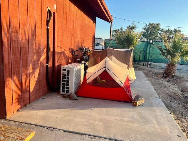
I was twelve miles from Brawley, and knew there was a twenty four hour truck stop there. My goal was to ride a hundred miles. I was looking for places to stealth camp as I neared the mark. It was dark and I could tell there were irrigation canals to both sides of the highway. I was riding through alfalfa fields, and the stealth camping options weren't good. After I hit my century I noticed a farm house with a few surrounding trees. I located a crossing over the canal, and wound my way around the yard. I pitched my tent next to a shed.
 |
| Sunrise outside of Quartzite |
 |
| The hills outside of Quartzite where I wild camped |
 |
| Crossing the Colorado River |
 |
| Giant bales of alfalfa grass hay |
 |
| Welcome to California! |
 |
| Another healthy breakfast! |
 |
| Alfalfa grass fields and irrigation canal. |
 |
| Brutal heat |
 |
| Strawberry Icy and Chavito Mexican peanuts at the Chevron station in Palo Verde |
 |
| Parched Roadkill |
 |
| Parched dirt |
 |
| Brutal heat |
 |
| Emergency protein fix |
 |
| Saved by the Pepsi machine at the Glamis Beach Store |
 |
| North Algodones Dunes Wilderness Area |
 |
| Sunset over the North Algodones Dunes Wilderness Area |
 |
| Roadside shrine |
 |
| Map / Elevation Profile |


Comments
Post a Comment